A pilot initiative that will change how cyclists and scooter riders – as well as delivery messengers, couriers, and residents — get around cities is winning international attention, even before its planned July launch.
Bird, the shared electric scooter transportation company, and Trailze, the Israeli navigation tech startup that is remapping the urban grid, announced in mid-June that they’re collaborating on a pilot, the Bird Maps app, which will offer navigation specifically created for riders of human-scale vehicles to safely navigate urban streets.

“We looked for the need, not the solution,” Ronen Bitan, CEO at Trailze, tells NoCamels about his company’s groundbreaking navigation software. “Google maps is amazing for cars. But there’s a huge vacuum when it comes to city navigation for cyclists and scooter riders.”
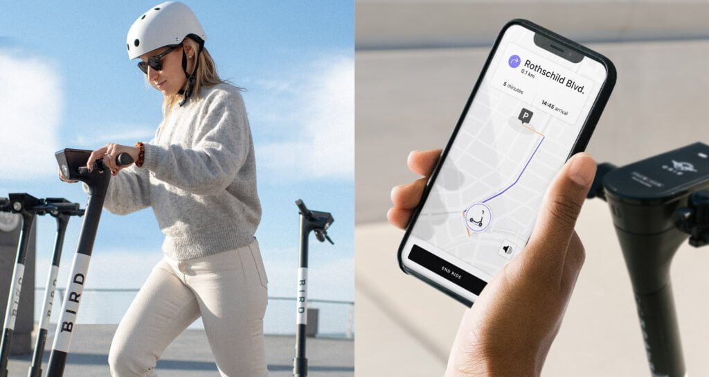
Bird Maps is a free standalone app, available soon on iOS and Android, that will allow riders the opportunity to enter their destination information and get in return audio and visual turn-by-turn navigation.
“Our vision at Trailze is to make riding human-scale vehicles the easiest and safest option for all,” says Bitan. “We couldn’t be more excited to join forces with Bird, the Apple of the shared micromobility space, and use our unique navigation technology to revolutionize the way people move around in our cities.”
Indeed, how people and goods get around our cities is changing every day. New shared mobility options propose lower emissions, better safety, and enhanced affordability.
“With millions of people embracing shared electric micromobility and cities everywhere committing more resources to the development of bike and micromobility lanes, we wanted to ensure that riders could more easily navigate and utilize city infrastructure,” Patrick Studener, Head of Bird EMEA, said in a press statement.
Before COVID-19, electric scooters and electric bicycles were slowly gaining traction as the transportation mode of choice for inner city destinations the world over. Shared electric scooters are used in 626 cities, in 53 countries and have made over 300 million trips, according to an EY report.
During COVID-19, over 300 cities introduced plans for more than 2,600 additional kilometers of slow streets and temporary bike lanes. Among them, the Tel Aviv-Yafo municipality recently approved a strategic plan to double the length of bike paths in the city from 140km to 300km by 2025.
Now, as municipalities emerge from the novel coronavirus lockdowns, Bitan says the demand for sharing e-scooters or e-bikes is growing.
“COVID19- turned a lot of people to micromobility for obvious reasons: people don’t want to enter shared cars or taxis anymore, deliveries are more popular and they need micromobility to make them cost-effective, and people saw their cities with less pollution and want it to remain clean. Micromobility offers great solutions,” he tells NoCamels.
Indeed, market reports show that this could be micromobility’s big moment.
And Bird, the leader in shared electric scooter transportation, has chosen to show that getting people where they need to be in a safe manner is possible with Bird Maps.
“By working with Trailze to pilot Bird Maps in Paris and Tel Aviv – two cities that have recently committed to and developed additional bike lanes – we are making it easier for riders to feel more comfortable and safe as they move about their cities without relying upon cars and hope to pave the way for increased adoption and usage of clean transportation,” says Studener.
Navigating the desert to city streets
The groundbreaking SDK (software development kit) platform traces back to navigating Israel’s sand dunes.
Back in 2014, Bitan, a mountain biking enthusiast, set out on a long cycling adventure through the desert. The paper maps and GPS options available at the time weren’t to his liking. So, he decided that with his decade-plus navigation technological expertise background, he could create a better way to navigate the outdoors.
And so, in 2015, he launched the Trailze Biking Hiking Outdoor navigation app. Through word-of-mouth chatter, 200,000 people downloaded the offline smart maps app and gave it rave reviews.
But in late 2019, Bitan understood that the outdoor market didn’t need his app. “It was nice to have, it wasn’t a must,” he says.
There were others that offered similar solutions and off-road adventurers still prefer paper maps, he says.
Sign up for our free weekly newsletter
Subscribe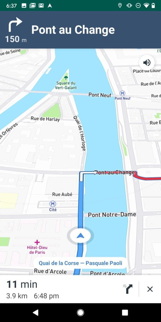
It was time to pivot the technology.
Trailze CTO Noa Levy had the idea for city navigation for cyclists. After all, both Bitan and Levy knew that “people were using our Trailze Biking Hiking Outdoor navigation app for city use and the question was why,” Bitan tells NoCamels.
So, Bitan wrote to the users and asked them for feedback.
“Israeli culture is a good place for feedback. Israelis like to tell you what’s wrong. Instead of getting insulted, you can learn from the feedback and use this information to improve your product,” says Bitan. “It’s never the same in the lab and in the open. We run a beta program on bikes and scooters… you can learn a lot more from customers than in the lab.”
It makes sense that this navigation system for the micromobility world would start in Israel. Israeli entrepreneurs are globally recognized for their navigation technology capabilities.
Waze (GPS navigation software app owned by Google), Moovit (mobility as a service provider and journey planner app recently acquired by Intel), Navin (indoor navigation), Oriient (in-store navigation) and Sidekix (walking navigation app) are among the many commercial routing solutions born in Israel.
“Waze and Moovit are the two major successes of this industry. We’re looking to be the third,” says Bitan.
Watch out for the pothole!
The Bird-Trailze collaboration has deservedly garnered headlines. But it is only one of many exciting features this navigation platform has in store for the micromobility sector.
Trailze is looking to become the go-to navigation platform for cities worldwide.
“We are a platform, we are not trying to create an app,” says Bitan, noting that his company’s software can be embedded into “a city app, railway app, delivery service app, etc.”
The Israeli SDK platform can give micromobility companies, municipalities, transportation, and delivery services key infrastructure logistics not freely available today.

“We thought we can make the road safer, we can help riders, and that’s awesome but we realized that’s the smallest part of what we can do. Logistics are the biggest problem,” says Bitan.
He cites Uber as an example of using map data and location services to improve fleets.
“The scooter operators know where each scooter is parked but they don’t know where the scooters are heading, they have no clue where the scooters go,” says Bitan.
The Israeli software is embedded into Bird Maps. When a rider types in a destination, the micromobility operator will know where the scooter is going, how much battery power it needs for the ride, and where to pick it up.
Trailze has plans to add real-time alerts that are infrastructure-sensitive: warning riders of wet or icy streets, potholes or uneven roads, where to find a cobblestone street, and updating municipalities where accidents happen.
“We would like to release our product with as many potential customers as we can and reduce accidents and improve safety,” says Bitan. “We really believe we’re creating a better world. In five years, we hope a lot more people are using micromobility because of us.”
Viva Sarah Press is a journalist and speaker. She writes and talks about the creativity and innovation taking place in Israel and beyond. www.vivaspress.com
Related posts

Editors’ & Readers’ Choice: 10 Favorite NoCamels Articles

Forward Facing: What Does The Future Hold For Israeli High-Tech?

Impact Innovation: Israeli Startups That Could Shape Our Future





Facebook comments