This article was written for NoCamels by ZAVIT – Science and Environment in Israel.
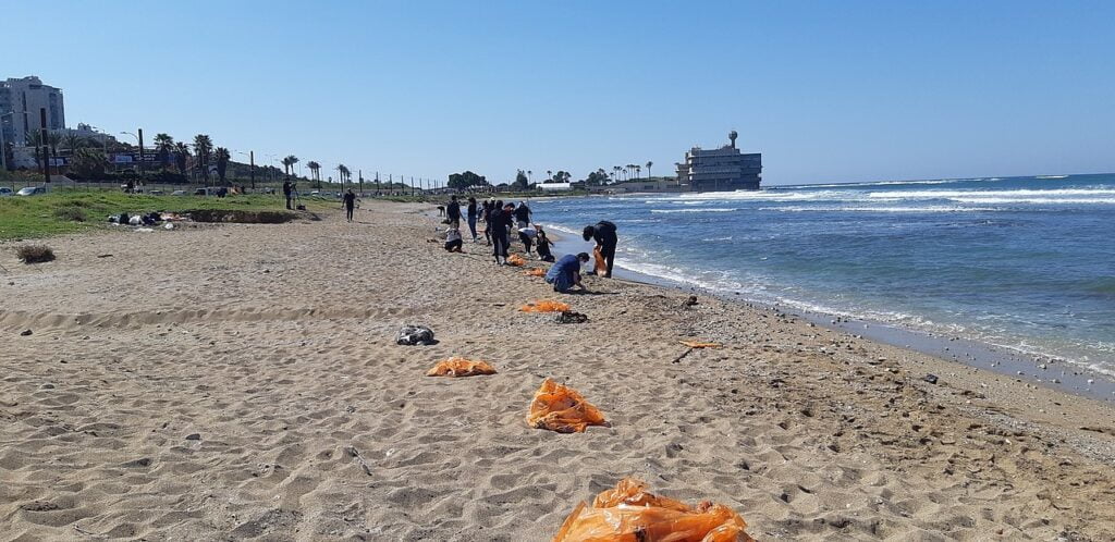
In February, Israel found itself in the midst of one of the most serious environmental events the country has ever experienced. Over a thousand tons of tar reached the shores of the Mediterranean Sea after an oil tanker leaked oil about 50km off the coast, prompting an investigation and a mass volunteer clean-up effort. Through it was organized by the Ministry of Environmental Protection, the Nature and Parks Authority, environmental organizations, and local authorities, it was citizen reporting of tar buildup along the beaches that led to the mass clean-up campaign.
SEE ALSO: Israeli NGOs Say Oil Spill A ‘Wake-Up’ Call For Better Sea Conservation
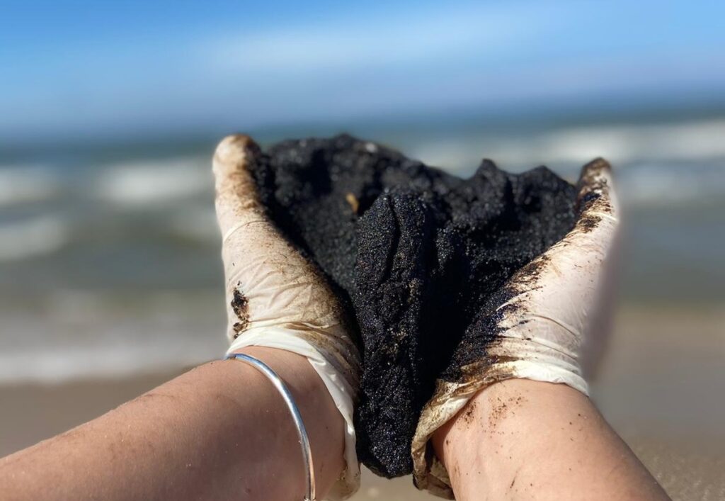
In the time since, these efforts have helped remove much of the tar buildup and the tar still drifting ashore, emphasizing the importance of volunteer citizens and their contribution to environmental disasters such as this one. However, the work is not yet complete and some Israeli beaches are still contaminated.
Researchers also believe that Israel has not yet seen the final wave of tar. In the meantime, more work is needed to prevent or minimize such environmental incidents – and this includes quicker detection processes.
Real-time updates on tar sightings
The citizen science initiative Meduzot Ba’Am, or “Jellyfish Inc.,” is an application and website where citizens can report jellyfish sightings and receive real-time information concerning the distribution of the gelatinous animals on Israel’s shores. In light of the recent oil spill, the organization has launched a new map dedicated to reporting tar sightings on beaches or at sea. Like the original initiative, the tar reports appear on a map that is updated in real-time (jellyfish sightings are ongoing).
“We created the tar report map because we understand the importance of a map that will help us direct our cleaning efforts,” says Dr. Dor Adelist, a marine ecologist from the University of Haifa and one of the founders of Meduzot Ba’Am who has also volunteered with beach cleaning efforts in recent weeks.
“We need some kind of information that helps us determine if our cleaning is effective, or if beaches are still receiving tar after we clean them. Basically, we want to know when tar stops showing up on a specific site and monitor it so that we can know when we can stop cleaning that beach,” adds Dr. Adelist.
According to the marine scientist, the map also serves citizens. Just as beachgoers use the jellyfish map to determine which beaches they should visit and which to avoid, they will do the same for tar as well.
After all, summer is near, and people visiting beaches will want to know where the tar is lingering.
“As someone who volunteers to clean beaches, I can say with certainty that there is still a lot of tar, and that more washes ashore every day,” says Adelist.
A network of volunteers at sea
The February incident has highlighted the key role environmental organizations played in reporting tar sightings. And their coordinated beach cleanups proved to be essential.
“When we initially received the pictures of the tar, the first thing we did was speak with the Ministry of Environmental Protection to see what they knew,” says Dr. Michal Stern, director of the national network of marine emergency volunteers at Eco-Ocean.
“We immediately began the recruitment process. We opened a registration form and distributed it in every possible way. We have, for example, opened a WhatsApp group for volunteers and added anyone that signed up through the registration form. We quickly reached a situation where we had groups with over 4,000 people registered. But each WhatsApp group can only support up to 250 participants so at some point we even got blocked. Later, when the number of volunteers reached over 12,000, we moved to a CRM system instead.”
At Eco-Ocean, which in recent years has operated a nationwide network of emergency volunteers at sea and onshore, groups of volunteers are currently collecting data that is being transferred to the ministry for the purpose of understanding the situation on the ground.
Sign up for our free weekly newsletter
Subscribe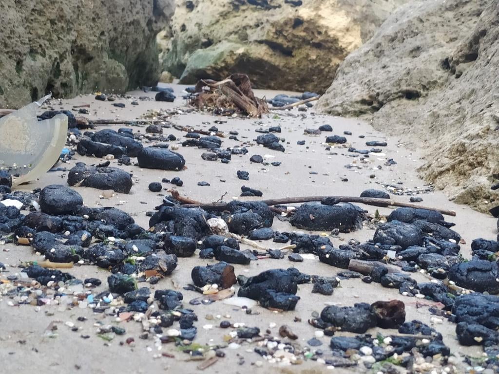
“Usually, the situation in the field is obtained by inspectors from the Ministry of Environmental Protection’s marine unit, but there are about 30 inspectors, ten of which are at a marine pollution station in Eilat,” explains Stern. “Indeed, many of the reports we have received came from marine emergency volunteers who have had prior training. However, lots of information has reached us from concerned citizens through social networks.”
Quality information in real-time
“Citizens’ reports make it possible to obtain current information that has never been this detailed for pollutants of crude oil, fuel oil, and other fuels both in the water and especially on the coast,” says Dr. Adi Levi, scientific director of the Israel Society of Ecology and Environmental Sciences and head of the Division of Environment and Sustainability at Achva Academic College.
“The reports will allow researchers and the public to know on a daily basis where the tar contamination is, or even where a localized oil stain is located, and better monitor the situation on the ground. Of course, the map and its real-time reports additionally help the public access cleaner areas of the beach,” he explains.
According to Dr. Levi, the marine environment in the southeastern Mediterranean is one of the busiest areas of the world due to the large volume of cargo ships and tankers transporting crude oil through the Arabian Peninsula via the Suez Canal to Europe and America. Existing and planned deep sea gas and oil wells and their accompanying infrastructure also contribute to this.
In addition, the Europe-Asia Pipeline Co. is also planning on moving oil from Eilat to Ashkelon and loading it on over 50 tankers per year to Europe at a significant risk to the unique coral reefs in Eilat and Aqaba and the marine ecosystem in the eastern Mediterranean.
The reported data is used for long-term research and helps researchers understand the trends and scope of common contamination events, even if it is not as widespread and prominent like the recent spill.
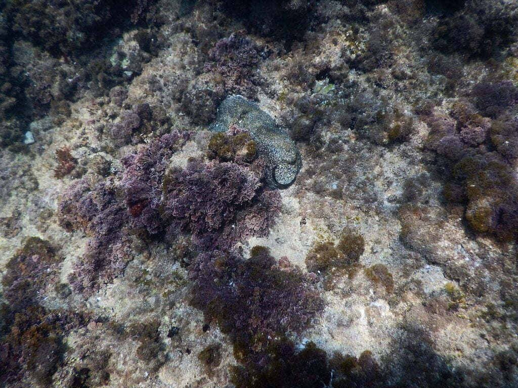
“The information will enable us to identify even the smaller and more local events that cumulatively and severely affect the flora and fauna in the marine environment––impacts that may lead to impaired reproduction and regeneration of marine life, poisoning, and even death,” Dr. Levi explains.
According to Dr. Stern, the number of volunteers registering for cleaning efforts has decreased and it is much more difficult to recruit volunteers than it was in the first two weeks. “From the beginning, it was clear to us that the tremendous public attention would not last long. So, we tried to take advantage of the momentum and the … media and public attention surrounding the event and set up as many stands as possible and as quickly as we could,” she says.
SEE ALSO: How Israeli Tech Protects The World’s Most Scarce, Essential Resource: Water
“The response was amazing. People came and worked really hard. It’s hard physical work and we just saw amazing people coming from all over the country making a difference. Without them, the situation would have looked completely different.”
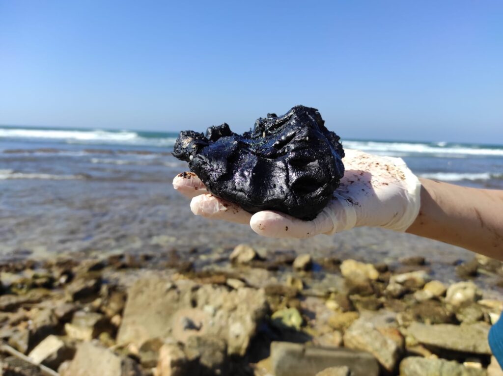
“Until the event is over, we need to be keeping our finger on the pulse to know where to direct our cleaning efforts,” says Dr. Adelist. “We suspect that there is still a lot of oil in the sea, not all of which has reached the coast.
Oil pollution causes very widespread damage to marine life, something that we do not yet know how to assess because the incident has not ended yet,” he concludes.
To report jellyfish sightings and tar pollution on beaches, please visit www.meduzot.co.il
Related posts

Resilient And Nutritious New Plant-Based Milk Aims To Make A Splash

Chocolate From Cultivated Cocoa Comes Without Environmental Toll
Plastic Fantastic: Startup Takes PVC Back To Its Crude Oil Roots



Facebook comments