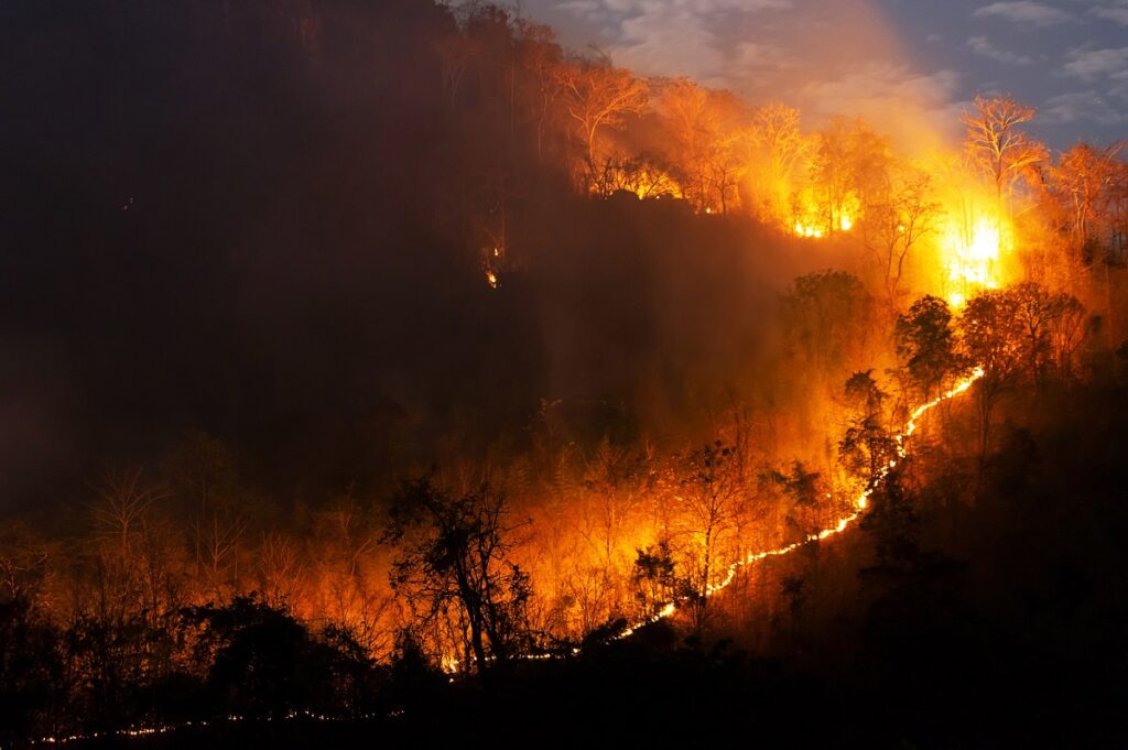
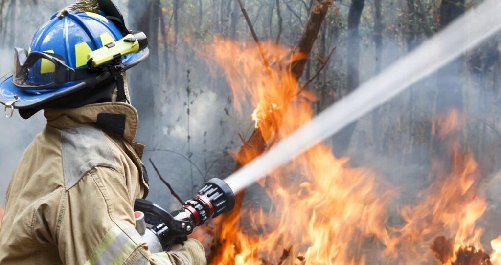
Over the weekend, firefighters struggled to contain a wildfire that broke out on private land north of Ocate, New Mexico. The Cooks Peak Fire, which began on Sunday afternoon, burned through at least 300 acres with grass and ponderosa pine continuing to fuel it, the state’s fire authorities said, according to Newsweek. It was the latest in a series of wildfires that had swept through the southwestern US state this month.
A week earlier, five large wildfires burned through more than 13,000 acres of land in New Mexico, forcing evacuations and damaging homes, according to data from the Incident Information System reported on CNN.
Wildfires are nothing new, particularly in dry regions of the United States. In New Mexico, fire season was said to have come early as snow from the mountains melted faster than usual and strong winds mixed with dry air hit trees, grass, and brushes. Besides the immediate effects of the fires in specific areas, the looming damage continued with poor air quality conditions, which exist and remain harmful even when fires are miles away. In a media release, officials in the New Mexico Department of Health warned the population to maintain air quality safety as air quality conditions “may be harmful to the health of at-risk populations,” can create unsafe driving conditions, and exposure to smoke can “aggravate conditions such as asthma, chronic lung disease, or cardiovascular disease.”
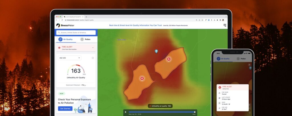
Breezometer, an Israeli company that empowers people to make healthier decisions, might not be able to prevent the next wildfire, but it can help individuals prevent its hazardous effects. Last year the company launched a Wildfire Tracker, a global monitoring system that delivers accurate status updates of current and impending fires using satellite imagery, sensor data, local reports from firefighters, and algorithms developed by a team led by the company’s Atmospheric Science Specialist Dr. Yvonne Boose.
The tracker provides personalized alerts notifying users of fires in their vicinity up to a radius of 19 to 62 miles from the exact location and also creates a polygon-shaped outline around the fires that represents the total area that will be consumed by flames. As the fire moves, so does the perimeter on Breezometer’s map of the area. The tracker also provides in-depth information about the fire including boundaries, distance, and direction from particular positions, as well as wind speed, size, and even estimated time to containment.
Dr. Boose tells NoCamels that the reason that the Wildlife Tracker is accurate and successful and that its “secret sauce” — is providing information “by combining all kinds of sources and not relying on a single source.”
“Most of what has been out there before relied mainly on one type of satellite or on ground observations only or on the reports that individuals — like many authorities just have a map and put a pin on it where someone reported a fire and this can be true, but it can also be someone that just saw someone burning some trash in their garden,” she explains, “So what we’re doing here is really this combination and filtration have data that to prevent false positives.”
According to Boose, the best is taken out of the collected satellite data. “We have experienced software developers and engineers. So we’ve developed a range of algorithms.”
Boose says that the Breezometer team collects and integrates “all the data we can get. “It’s mainly satellite data because that is what provides us with global coverage,” she says, “So we use various satellite imagery, but also, we refer to local sources, like fire brigades on the ground that provide additional information and we provide them to our users as additional add-on information. And we use other data such as land cover and terrain, and also our own air quality model to fee back into the fire perimeters.”
Breezometer launched its Wildfire Tracker in August 2021, seven years after the company was founded in 2014. The company also provides street-level and real-time air quality information including air pollution and pollen. Breezometer is perhaps best known for its air quality index (AQI) calculations, which identify the quality of air down in countries around the world and display that information on the company’s website and mobile app.
Sign up for our free weekly newsletter
SubscribeTo measure air quality, “we use 60 to 70,000 ground sensors that measure all kinds of parameters. So small particles or gases such as carbon monoxide or nitrogen dioxide contribute to air pollution – not only from wildfires – but general air pollution, and all these sensors are integrated into our data flow to provide the best information combined from all our different sources,” Boose says.
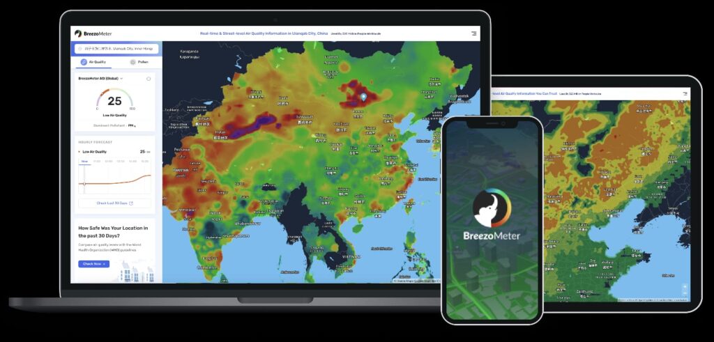
The Israeli startup currently has a partnership with Apple to include its data in the iOS Weather app to deliver those metrics to millions of its users. The company’s API product also allows companies to use its data for their own purposes.
Breezometer’s Wildfire Tracker also measures air quality metrics, along with the fire’s perimeter. This is especially important, considering the circumstances because the smoke from wildfires can travel long distances, without populations even knowing they are being affected by it.
“The most interesting and also awful thing about wildfires is that it doesn’t only affect people in its surrounding areas. The smoke can travel ten or even 100 miles away from the actual fire,” Ran Korber, CEO, and co-founder of Breezometer, tells NoCamels. “We’ve heard of wildfires [from the Midwest] that even traveled as far as the East Coast. So that’s one of the phenomenons that impact air quality as well.”
The impact of climate change on wildfires
The recent conflagrations in New Mexico and now, in Arizona, are the latest in a long line of wildfire disasters around the world fueled by the climate crisis. In the last year alone, wildfires burned over 2.5 million acres of California land and destroyed more than 3,600 structures. The infamous Australian bushfire that peaked in early 2020 was even worse as it burned 46 million acres, destroyed almost 6,000 structures and homes, and killed 479 people, including 34 directly and 445 indirectly via smoke inhalation.
With wildfire events projected to increase as much as 14 percent by 2030 and 30 percent by 2050, the UN Environment Program suggested we “learn to live with fire” and find ways to adapt to its growing frequency and severity, CNN reports.
“As we speak out tens of thousands of wildfires are happening and wildfires are becoming more frequent and more hazardous. It’s also impacting air quality, which eventually impacts climate change. It’s this endless loop that is, is increasing and hurting people’s health and safety,” says Korber, “Unfortunately, because of climate change, many environmental hazards are becoming more frequent and more hazardous. What we believe at Breezometer is that in order to do that every consumer experience, every product, and every business process must become what we call climate aware and climate-resilient. The world used to be about mobile apps and cloud technologies, and now AI is part of our everyday lives. Similarly, Breezometer’s health focus and environmental intelligence should be everywhere, enabling the transformation of business and consumer experience to become climate aware and climate-resilient. And what we believe is that by providing the most accurate, health-focused environmental intelligence, which is accurate and actionable environmental data and insights, we can achieve this goal.”
Additional reporting by Max Kaplan-Zantopp
Related posts

Resilient And Nutritious New Plant-Based Milk Aims To Make A Splash

Chocolate From Cultivated Cocoa Comes Without Environmental Toll
Plastic Fantastic: Startup Takes PVC Back To Its Crude Oil Roots


Facebook comments